Chapter 10 — Coasts, estuaries and mangroves
Exam link: common foundation; AP coastal examples.
Learning aim: explain estuarine gradients, mangrove structure and coastal ecosystem connections without treating one restoration action as a cure for every hazard.
10.1 A coast is a moving boundary
The coast is where land and sea interact. Waves, tides, currents, sediment supply, river discharge, wind, storms and human structures continually shape it. A shoreline on a map is a dated representation; the physical boundary can shift. Coastal ecosystems include beaches, dunes, tidal flats, estuaries, lagoons, salt marshes, seagrass and mangroves. Not every coast contains every habitat.
The ecological condition of a coast depends on processes as well as visible cover. Sediment movement maintains or erodes landforms; freshwater inflows influence salinity; tides exchange water and organisms; vegetation can trap sediment or reduce local flow. A seawall can protect a particular built edge while changing erosion or habitat elsewhere. Coastal management therefore considers the wider sediment cell or connected landscape, not just one property line.
10.2 Estuaries join freshwater and marine processes
An estuary is a coastal water body where freshwater from land mixes with seawater. Salinity may vary from riverward to seaward and with tide, rainfall, discharge, evaporation and season. The mixing pattern is not always a smooth gradient; channel shape and flow can create complex zones.
Estuaries can support high biological productivity and provide nursery, feeding or refuge habitat for some species. Nutrients, sediment and organic matter move through the system. The ecological value depends on water quality, tidal exchange, substrate, vegetation and human use. An estuary is not merely a river mouth, and not every river mouth has the same ecological structure.
10.3 Mangroves: adaptations and dependencies
Mangroves are salt-tolerant woody plants that occupy intertidal settings in tropical and subtropical regions. Different species manage salinity in different ways, including salt exclusion at roots, salt excretion through leaves or storage/tolerance strategies. Root forms such as prop roots and pneumatophores help with support and gas exchange under waterlogged, oxygen-poor soil. These adaptations vary across species; do not attribute every root shape to every mangrove.
Mangrove stands provide habitat and can attenuate waves and currents locally, trap some sediment and support carbon storage. Their protective effect varies with width, density, species, water depth, storm characteristics, shoreline shape and the condition of the stand. A mangrove belt should not be described as a guaranteed shield against all cyclones or storm surges. It is one part of risk reduction alongside land-use planning, early warning, safe buildings and evacuation.
Mangroves also depend on hydrological and geomorphic processes. A stand may decline if tidal channels are blocked, salinity shifts beyond a suitable range, freshwater supply changes, sediment is removed or shorelines are hardened. Planting seedlings where the water regime is wrong can fail. Restoration should diagnose why mangroves were lost, restore appropriate conditions, use locally suitable species and monitor natural recruitment and survival.
10.4 Coringa as an AP estuary–mangrove case
Coringa Wildlife Sanctuary is an Andhra Pradesh coastal conservation landscape associated with mangrove habitat near Kakinada. The State Forest Department describes its mangrove ecosystem and wildlife, while statutory extent and zonation must be taken from the relevant original notification and current management material. This book will not repeat area or species totals from older forest documents as if they were current.
Coringa illustrates an ecological connection between river discharge, tidal channels, sediment, vegetation and coastal livelihoods. Mangrove roots provide physical structure; tidal exchange carries water and organisms; upstream land and water decisions can influence sediment or freshwater. A conservation plan that focuses only on the trees may miss the channels and catchment processes on which the stand depends.
10.5 Coastal change and climate risk
Sea-level rise, changing storm patterns, erosion, subsidence, land conversion and infrastructure can combine to affect coastal habitats. Risk is not set by the hazard alone. Exposure and vulnerability matter: settlements, roads, livelihoods and ecosystems differ in their location, design and capacity to recover.
Adaptation options may include avoiding new construction in high-risk areas, maintaining room for wetlands to migrate inland, restoring tidal exchange, strengthening warning systems and designing infrastructure for local conditions. Hard structures, nature-based measures and managed retreat involve different trade-offs. A solution at one site can shift erosion or flood risk to another. Environmental assessment should consider cumulative and cross-boundary effects.
10.6 A coastal food and sediment pathway
Leaf litter and other organic matter from mangroves can enter tidal creeks and become part of detrital pathways. Small invertebrates feed on or process material; fish may use creeks as feeding or nursery habitat; birds and people may depend on these resources. The pathway connects habitat structure to ecological and livelihood outcomes. However, the popular claim that all mangrove-derived material fuels all coastal fisheries is too broad. Contribution varies by species, hydrology and food-web route.
Sediment adds another pathway. Roots can slow water and promote local sediment deposition in some settings. If sediment supply is cut off, a mangrove platform may not keep pace with changing water levels. If sediment input is excessive or channels are altered, drainage and vegetation may also change. The relationship is dynamic and must be measured.
Figure 10.1 — Estuary-to-coast gradient: show river inflow, mixing zone, tidal channels, mangrove fringe and open coast; use opposing arrows for tides and a downstream arrow for river flow. Label salinity as variable with place and time.
Figure 10.2 — Mangrove structure and adaptations: illustrate a generalized prop-root and pneumatophore form, tidal water, oxygen-poor substrate and sediment flow. Label as representative forms, not a universal species diagram.
Worked case: seedlings survive but the forest does not recover
A project plants thousands of mangrove seedlings. A year later, many have died, and natural recruitment is low. Possible causes include unsuitable elevation, incorrect species, blocked tidal exchange, erosion, grazing or planting at the wrong season. The number planted measures an input, not restoration success. A better evaluation records water levels, salinity, sediment stability, species suitability, survival by location, natural regeneration and ecological function. The project should repair the underlying process before repeating the same planting design.
Exam traps and retrieval
- An estuary is defined by freshwater–seawater mixing, not just by a mapped river mouth.
- Mangrove species differ in salt-management and root adaptations.
- Mangroves can reduce local wave energy but are not an absolute cyclone barrier.
- Planting without suitable hydrology and elevation can fail.
- Coringa's current legal boundary and older area statistics are different claims and need different evidence.
- Coastal risk includes hazard, exposure and vulnerability; vegetation alone does not determine risk.
Draw a cross-section from an upland catchment to the sea. Mark two ways a road or embankment could alter tidal or freshwater flow. Then outline three monitoring measures that would show whether a mangrove restoration project is recovering ecological processes, not just seedling numbers.
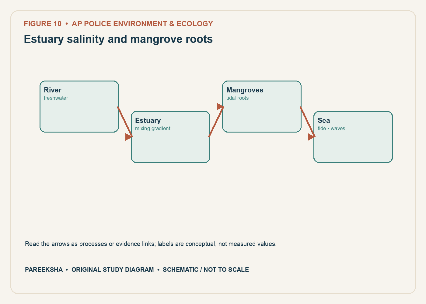
Figure 10.1 Estuary salinity and mangrove roots. Original explanatory diagram; schematic and not to scale.
Chapter practice questions
1. An estuary is generally a place where:
A. A glacier meets a desert
B. Groundwater never interacts with surface water
C. River freshwater mixes with seawater under tidal influence
D. A river has no sediment
Answer: C. Estuaries are transitional coastal systems influenced by freshwater, seawater and tides. Their salinity and ecological conditions vary with flow and tidal state.
2. Mangrove plants commonly show adaptations to:
A. Permanent freezing only
B. High-altitude snowfields
C. Absence of water
D. Salinity, waterlogging and unstable muddy substrates
Answer: D. Mangroves have varied adaptations for saline, oxygen-poor soils and tidal environments. Species differ in the specific strategies they use.
3. Pneumatophores are:
A. Aerial roots that can aid gas exchange in waterlogged soils in some mangroves
B. A type of fish scale
C. A coastal wind measurement
D. A pollutant standard
Answer: A. Pneumatophores are specialised roots that project above the substrate and facilitate gas exchange in oxygen-poor sediments for some mangrove taxa.
4. Why are mangroves often described as nursery habitats?
A. They produce all marine fish
B. Their complex structure can provide shelter and feeding areas for juvenile organisms
C. They prevent every predator from entering
D. They exist only in freshwater lakes
Answer: B. Root structure and food resources can support juvenile stages of various organisms. Nursery function varies by species and site.
5. Which is the most scientifically careful statement about mangroves and storms?
A. Any mangrove strip prevents all cyclone damage
B. Mangroves eliminate the need for evacuation
C. Mangroves can reduce some wave energy in suitable settings, but protection varies with forest and storm conditions
D. Mangroves stop sea-level rise
Answer: C. Mangroves can provide coastal buffering, but protection depends on width, density, topography, water depth, storm characteristics and other factors. They are not a substitute for risk planning.
6. Coringa Wildlife Sanctuary is associated with which ecological setting?
A. Himalayan alpine meadow
B. Thar Desert salt flat
C. A cold-water coral reef
D. Godavari estuarine mangroves
Answer: D. Coringa is in the Godavari estuarine region and is known for mangrove habitat. Current boundary and area figures should be taken from the state notification or department source.
7. Which factor can alter salinity in an estuary?
A. The balance among river discharge, tide and evaporation
B. The colour of nearby buildings alone
C. The number of tree species in a distant forest only
D. Earth’s magnetic field alone
Answer: A. Salinity responds to freshwater flow, tidal exchange and evaporation, among other factors. It can vary along the estuary and with season.
8. Mangrove carbon stores may occur in:
A. Sunlight alone
B. Above-ground biomass and waterlogged soils or sediments
C. The atmosphere only
D. Salt crystals without organic matter
Answer: B. Coastal “blue carbon” includes carbon in vegetation and often substantial soil or sediment pools. Site-specific estimates require appropriate sampling and accounting boundaries.
9. A mangrove restoration project plants seedlings but blocks tidal channels. What is the most relevant concern?
A. Tidal exchange is irrelevant to mangroves
B. Seedling count guarantees long-term survival
C. Hydrological conditions required for establishment may be impaired
D. Every planted area becomes a mature forest immediately
Answer: C. Tidal elevation, inundation and salinity influence mangrove establishment. Restoring hydrology and natural regeneration can be more important than planting numbers alone.
10. Why can a coastal embankment affect a mangrove ecosystem?
A. It makes the site immune to pollution
B. It creates new species automatically
C. It removes the need for monitoring
D. It may change tidal flow, sediment movement and salinity patterns
Answer: D. Structures can alter hydrological connectivity and sediment exchange. The direction and magnitude of effects require local assessment.
11. Which activity can damage mangrove habitat if poorly planned?
A. Filling or draining intertidal areas
B. Monitoring seedling survival
C. Mapping tidal channels
D. Protecting natural regeneration
Answer: A. Filling and drainage can remove habitat and change hydrology. Monitoring and protection are conservation actions when designed appropriately.
12. An estuary has a longitudinal salinity gradient. What does this mean?
A. Salinity is identical at every point
B. Salinity can vary from river-influenced upstream areas toward marine-influenced areas
C. Only air temperature changes along the estuary
D. The river and sea cannot mix
Answer: B. Freshwater and marine inputs create spatial gradients, though tides and mixing can complicate the pattern. Sampling should include locations and tidal stages.
13. Which statement about sediment in an estuary is correct?
A. Sediment is unrelated to coastal geomorphology
B. Estuaries contain no suspended material
C. Sediment transport and deposition can shape channels, mudflats and habitat
D. Sediment always increases mangrove survival
Answer: C. Estuarine sediment is moved and deposited by river flow and tides, shaping geomorphology. Excess or reduced sediment supply can each cause ecological change.
14. Why should a mangrove area estimate include a date and definition?
A. Mangrove area never changes
B. Dates are irrelevant to satellite imagery
C. Definitions are identical in every dataset
D. Mapping methods and canopy thresholds can change, so different estimates may not be comparable
Answer: D. Remote-sensing methods, resolution, canopy criteria and reference years affect reported area. A dated definition supports valid comparison.
15. What does “blue carbon” refer to in conservation discussions?
A. Carbon captured and stored in coastal and marine ecosystems such as mangroves, seagrasses and tidal marshes
B. Carbon in blue-coloured minerals only
C. All emissions from shipping
D. A type of atmospheric nitrogen
Answer: A. Blue carbon describes carbon in coastal and marine vegetated ecosystems and their sediments. Carbon accounting must define the ecosystem and measurement boundary.
16. Which is the most useful baseline for evaluating a proposed coastal project near mangroves?
A. One tree count from a different district
B. Multi-season data on vegetation, tidal channels, salinity, sediment, water quality and local use
C. A national annual average only
D. The project proponent’s logo
Answer: B. A baseline should match the likely impact pathways and capture seasonal variation. Social use and ecological data together improve the assessment.
17. A planted mangrove patch has high survival after one month. What is still needed to claim successful restoration?
A. No additional information
B. A second planting target only
C. Longer-term monitoring of structure, hydrology, biodiversity and ecosystem function
D. A photo without scale or date
Answer: C. Short-term survival is an input indicator, not proof of mature ecosystem recovery. Long-term structure, species composition and function need monitoring.
18. What is a key difference between a lagoon and an estuary in common ecological use?
A. A lagoon is always freshwater and an estuary always dry
B. They are identical legal categories
C. Neither is influenced by tides
D. A lagoon is often a shallow coastal water body partly separated from the sea by a barrier, while an estuary is a river–sea mixing zone; actual systems can overlap
Answer: D. These are broad geomorphic and ecological terms, and real coastal systems can share features. Site-specific classification should use hydrology and geography.
19. Which information helps determine whether a coastal fishery change is linked to an estuary alteration?
A. Long-term catch and effort data alongside flow, salinity, habitat and fishing-pressure records
B. One day’s catch without effort information
C. A list of unrelated tree species
D. A single map with no date
Answer: A. Fishery change may reflect habitat, hydrology, effort, markets and regulation. Multiple time-matched data streams help test possible links.
20. Which statement best describes the relationship between protected-area status and ecosystem function?
A. Designation guarantees no ecological change
B. Legal designation can support conservation, but ecological condition still needs management and monitoring
C. Protected areas require no enforcement
D. Designation replaces all coastal laws
Answer: B. Protected status provides a legal framework but does not remove external pressures or management needs. Condition and compliance remain important.