Chapter 11 — Wildlife conservation and protected areas
Exam link: common foundation; legal terms require current-text verification.
Learning aim: distinguish India's principal wildlife-protected-area categories, relate site designation to management objectives and understand how boundaries and rules are established.
11.1 Protection is a legal and ecological process
Protected areas are places set aside or managed for conservation under a defined legal or policy framework. The word “protected” is not enough to infer the exact activities allowed, the agency responsible or the boundary. Those details come from the relevant statute, notification, management plan and subsequent amendments.
India's Wild Life (Protection) Act, 1972 provides for several protected-area categories. The Ministry of Environment, Forest and Climate Change's wildlife pages identify national parks, wildlife sanctuaries, conservation reserves and community reserves as categories under the protected-area network. A release edition of this book must check the consolidated Act and amendments in force at the cutoff before describing any section, procedure or restriction.
11.2 National parks and wildlife sanctuaries
A national park and a wildlife sanctuary are both statutory categories under wildlife law, but their legal processes and rules are not identical. A sanctuary's rights, restrictions and permitted activities follow the Act and its notification; a national park has its own statutory regime. A learner should not assume that all human use is prohibited in every sanctuary or that every activity is permissible in every park. The specific notification and current law matter.
The boundaries are notified, not guessed from a tourism brochure. A district can contain part or all of a protected area; an ecological landscape may extend beyond it. A map should identify whether it shows the legal notified boundary, a management-zone map, a general location or a simplified study locator.
11.3 Conservation reserves and community reserves
The 2002 amendment to the Wild Life (Protection) Act introduced conservation reserves and community reserves. In broad terms, conservation reserves can provide a protected-area mechanism for government-owned areas, often adjoining or linking protected areas; community reserves provide for conservation on community or private land under the statutory framework. The exact statutory wording, procedure, committee composition and consequences must be checked against the amended legal text before release.
The two categories matter because conservation landscapes are not limited to large government parks. Community stewardship, corridors and buffer landscapes can support movement and reduce fragmentation. But legal designation does not itself guarantee adequate funding, participation or ecological outcome. Those depend on implementation, rights, management and monitoring.
11.4 Biosphere reserves: a wider landscape approach
A biosphere reserve is part of India's national programme aligned broadly with UNESCO's Man and the Biosphere framework. It is designed to connect conservation with sustainable use, research, education and participation across a representative landscape. Biosphere reserves commonly use core, buffer and transition zones as a planning model, but these terms do not automatically create the same legal restrictions as a national park or sanctuary.
The designation is therefore conceptually distinct from the statutory wildlife-protected-area categories. A biosphere reserve may include protected areas and human-use landscapes within a broader management frame. Inclusion in UNESCO's World Network of Biosphere Reserves is a separate international recognition. Always distinguish national designation, UNESCO network status and domestic statutory notification.
11.5 Tiger reserves and species-focused programmes
Tiger reserves are notified under the Wild Life (Protection) Act framework, with core/critical tiger habitat and buffer arrangements defined through the statutory process. The National Tiger Conservation Authority coordinates programme functions. A tiger reserve can overlap with a national park or sanctuary; it is not simply a synonym for either. For an AP example or current reserve boundary, use the latest notification and official NTCA/Forest Department material.
Species-focused conservation programmes can protect habitats beyond a single protected-area polygon. Corridors, conflict-mitigation zones, breeding sites, migration routes and community landscapes may matter. A species can move outside the legal boundary, so conservation planning uses the wider landscape while respecting land rights and safety.
11.6 Eco-Sensitive Zones
An Eco-Sensitive Zone (ESZ) around a protected area is notified through the Environment (Protection) Act framework and a site-specific Gazette notification. ESZ provisions are not one universal list of activities with one identical boundary. A notification may specify prohibited, regulated and permissible activities; the exact text, maps and subsequent amendments govern a particular site.
The MoEFCC ESZ notification portal lists draft and final notifications. Draft and final documents are different legal stages. A proposed boundary or restriction in a draft must not be presented as the final rule. Before giving an AP sanctuary example, record the sanctuary, notification number/date, final or draft status, boundary map and later amendments.
11.7 Protected areas and local communities
Conservation can affect people whose livelihoods, homes or customary practices are tied to a landscape. A rights-aware approach asks who participates, how decisions are made, what rules apply and how costs or benefits are shared. The legal status of land and forest rights is not interchangeable with ecological value; both need to be understood.
Human–wildlife interactions can occur inside and outside protected areas. Crop loss, livestock depredation, road accidents and risks to people require prevention, rapid response and transparent compensation or support mechanisms under current policy. Avoid framing all local residents as threats or all wildlife presence as a conflict. The specific species, season, landscape and incident matter.
11.8 How to read a protected-area map
Before answering a map question, check the map title, legend, date and source. Ask whether the line is an official notified boundary, a proposed ESZ, a tiger-reserve core/buffer, a district boundary or a generalized locator. A shaded polygon can mean several things. In this book's AP figures, symbols will show broad site locations only and will not imitate Gazette boundary maps.
Protected-area counts change when sites are newly notified, expanded, amended or reclassified. A national total must have a retrieval date and source. For exam preparation, category distinctions and legal process are more durable than an undated total. If a future exam asks a current number, it should be refreshed in a dated update sheet rather than silently embedded in an old print run.
Figure 11.1 — Designation and scale: show nested landscape concepts—wider biosphere reserve planning frame, protected-area legal polygon, potential corridor and human-use matrix—using distinct line styles. Add a note that overlap and legal status must be checked site by site.
AP application: Coringa and a surrounding ESZ
The MoEFCC ESZ record includes a final notification for the Coringa Wildlife Sanctuary (S.O. 3922(E), 21 September 2021). That dated legal record is a stronger source for the notified ESZ than an older tourism page. The final book should verify the linked Gazette document and its map before asserting boundary distances or restrictions. The sanctuary's ecological landscape and the ESZ are not the same polygon; one is a protected-area boundary, the other a surrounding notification with site-specific provisions.
Exam traps and retrieval
- National park, sanctuary, conservation reserve and community reserve are statutory categories; check current Act language and each notification.
- Biosphere reserve is a broad programme/planning concept; UNESCO network inclusion is a separate status.
- A tiger reserve can overlap another protected-area type; do not treat the names as interchangeable.
- ESZ draft is not final; site-specific final notification governs.
- A tourism map is not automatically a legally notified boundary map.
- Protected-area totals are date-sensitive; category definitions are more stable.
Given a map with a sanctuary, ESZ and district outline, identify which two lines could have legal effect and which might be only administrative. Explain what primary document you would check before answering whether an activity is allowed. Then state why a biosphere reserve should not be read as one uniform no-use zone.
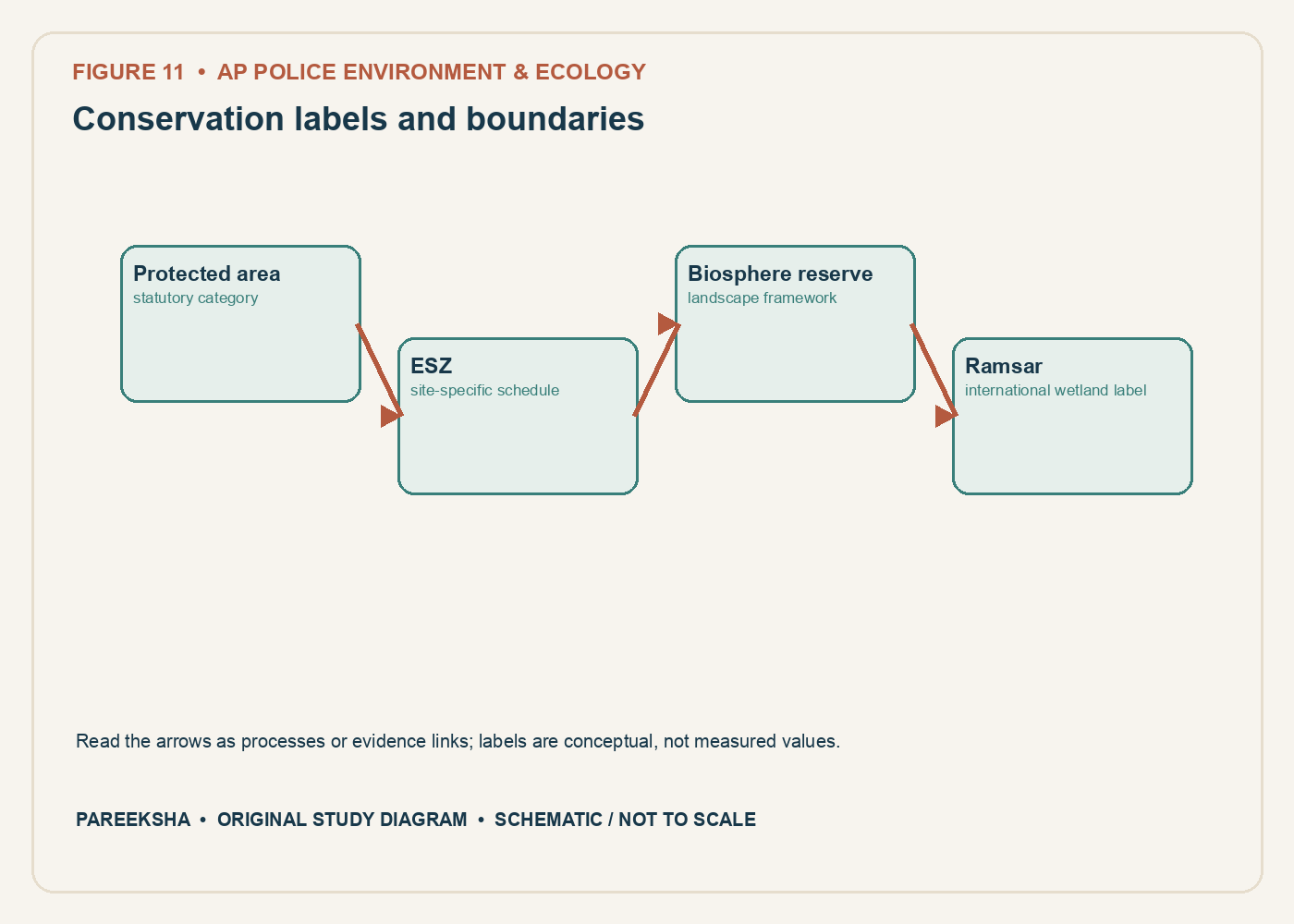
Figure 11.1 Conservation labels and boundaries. Original explanatory diagram; schematic and not to scale.
Chapter practice questions
1. A national park is best described as:
A. Any forest shown in a school atlas
B. An international wetland list
C. A statutory protected-area category under the Wildlife (Protection) Act, 1972
D. A local government garden
Answer: C. National parks are a statutory protected-area category under the Wildlife (Protection) Act. The legal notification and provisions determine the site boundary and applicable restrictions.
2. A wildlife sanctuary differs from a biosphere reserve because:
A. A sanctuary is always larger
B. A biosphere reserve is always a city park
C. Neither can include people
D. A sanctuary is a statutory protected-area category; a biosphere reserve is a broader conservation and sustainable-development framework
Answer: D. The two designations arise from different frameworks and purposes. Biosphere reserves may include core, buffer and transition areas; legal status depends on the specific instruments involved.
3. Which statement about a Ramsar site is accurate?
A. It is a wetland designated under the Convention on Wetlands as internationally important
B. It is another name for a national park
C. It automatically prohibits every human activity
D. It is an Indian district boundary
Answer: A. Ramsar status is an international wetland designation. Domestic law and site notifications govern local legal boundaries and activity controls.
4. An eco-sensitive zone (ESZ) around a protected area is established through:
A. A wildlife census alone
B. A site-specific notification under the applicable environmental framework
C. A tourism brochure
D. A district school syllabus
Answer: B. ESZs are notified through a legal process, and the final notification defines the area and activity schedule. Draft and final notifications must be distinguished.
5. Which statement about an ESZ is most careful?
A. Every activity is automatically banned
B. Every activity is automatically allowed
C. Activities may be prohibited, regulated or promoted according to the notification’s schedule
D. The ESZ always has one uniform width nationwide
Answer: C. The notification assigns activity categories and site-specific conditions. Width and terms can vary and may be amended or affected by court orders.
6. Conservation reserves and community reserves were added as categories under amendments to the Wildlife (Protection) Act. Their design can support:
A. Automatic conversion of all land to national park
B. Elimination of local participation
C. International listing only
D. Conservation on government or community/private lands under statutory provisions
Answer: D. These categories enable conservation in landscapes beyond the traditional national-park and sanctuary model, subject to the Act’s requirements and specific declaration.
7. A biosphere reserve’s transition area is generally intended to:
A. Support sustainable human activity alongside conservation objectives
B. Contain only a strict no-access zone
C. Function as a wildlife species list
D. Replace the state boundary
Answer: A. In the biosphere-reserve zonation concept, transition areas accommodate sustainable human activity. The exact governance and land status depend on the reserve framework and local laws.
8. Which is the best source for an exact protected-area boundary?
A. A travel blog’s screenshot
B. The applicable Gazette notification and official map or schedule
C. A species photograph
D. An undated social-media post
Answer: B. Legal boundaries are established by the relevant notification and referenced map or schedule. General web maps may be incomplete or not legally authoritative.
9. A protected area is surrounded by agricultural land. Which concern may require landscape-level management?
A. A legal boundary blocks all ecological processes
B. Species never leave protected areas
C. External pressures such as runoff, roads, fire and animal movement can cross the boundary
D. Land use outside cannot influence water
Answer: C. Ecological systems cross administrative boundaries. Buffering, connectivity and cooperation with local communities can matter for conservation outcomes.
10. When was the Wild Life (Protection) Amendment Act, 2022 brought into force according to the commencement notification?
A. 15 August 1947
B. 26 January 1950
C. 1 April 2026
D. 1 April 2023
Answer: D. The official commencement notification appointed 1 April 2023. A dated amendment fact should be verified against the commencement instrument, not inferred from assent date.
11. Why should a protected-area list include an “as on” date?
A. Notifications, renamings, boundaries and legal status can change
B. The list is a timeless natural law
C. Dates change the species’ DNA
D. An “as on” date replaces the source
Answer: A. Legal and administrative records can be amended. The date plus source identifies which version of the list is being used.
12. Which claim requires the most site-specific verification?
A. “The Wildlife Act is a national statute”
B. “This named ESZ permits a particular activity within a particular village”
C. “Protected areas support conservation”
D. “A habitat can extend across district borders”
Answer: B. Permitted activity depends on the exact final notification, location, map, amendments and sometimes judicial orders. Broad summaries cannot settle a parcel-specific question.
13. A biosphere reserve contains a national park in its core. Which statement is possible?
A. The two labels must have identical boundaries
B. Biosphere-reserve status cancels the park notification
C. The same landscape can carry overlapping designations with different purposes
D. Overlapping designations are impossible
Answer: C. Designations can overlap but are not interchangeable. Each framework has its own goals, legal basis and boundary.
14. The term “core area” in a biosphere-reserve framework usually refers to:
A. The only place where people can live
B. The entire transition area
C. A district administrative office
D. The area given strong protection for conserving ecosystems and species
Answer: D. Core zones are intended for strong conservation, often with strict protection. Actual legal status and access conditions depend on the national and site-specific arrangements.
15. What does a community reserve recognise in broad terms?
A. Conservation on community or private land through the statutory framework and participation
B. A Ramsar wetland by default
C. A protected area with no boundary
D. A type of forest survey
Answer: A. The category can support community participation in conservation on eligible land, subject to statutory conditions and notification.
16. Which is an effective conservation-management indicator?
A. Number of pages in a management plan
B. A measurable condition linked to the management objective, such as habitat connectivity or a species trend
C. Number of signs installed alone
D. Tourism revenue alone in every case
Answer: B. Indicators should test whether ecological objectives are being achieved. Administrative inputs may be tracked but do not substitute for ecological outcomes.
17. Why is “protected” not the same as “pristine”?
A. Protected areas have no organisms
B. All protected areas are newly created
C. Legal status does not eliminate past degradation, external pressures or ecological change
D. Protection means no monitoring is needed
Answer: C. Protected areas may face pollution, invasive species, climate impacts, conflict and legacy pressures. Management and monitoring remain necessary.
18. Which source should control a question about the current schedule of activities in an ESZ?
A. A draft notification only
B. A general protected-area fact sheet
C. A national newspaper headline alone
D. The latest final Gazette notification and amendments for that named ESZ
Answer: D. Activity schedules are site-specific legal terms. Drafts do not have the same status as final notifications.
19. A sanctuary notification map and a Ramsar site map differ in outline. What is the best explanation?
A. They may represent different designations, purposes and boundary sources
B. One must always be fraudulent
C. They are required to match exactly
D. Maps cannot show wetland boundaries
Answer: A. Legal protected-area and international wetland boundaries are defined for different frameworks. They may overlap without being identical.
20. Which principle best supports involving local resource users in conservation planning?
A. Local knowledge always replaces scientific measurement
B. Their knowledge and rights can improve ecological understanding and the fairness of management
C. Participation removes all trade-offs
D. Resource users cannot observe seasonal change
Answer: B. Local observations can complement formal data, and participation helps identify rights and effects. Neither source automatically replaces the other.