AP Geography — Rivers, Districts, Ports and Projects · Chapter 4
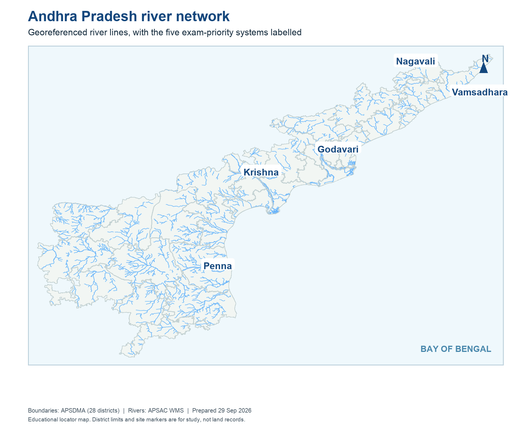
Andhra Pradesh river network
The five named systems are placed over the AP government river layer; thinner blue lines show other mapped waterways.
Districts: APSDMA. Rivers: APSAC WMS. Educational site locators: OpenStreetMap and official project records.
Read this map
Follow the broad river lines from inland catchment to the Bay. The basins are not district boundaries. When a river crosses two administrative areas, keep one continuous river line and change only the district label. This is the first check for a project location question.
On what you just read, from the live question bank. 🔒 Answers and solutions are shown to registered students (free). अध्याय पढ़ने के बाद अभ्यास करें।
1.Kanuma festival is celebrated on which day of Sankranti by Hindus in the south Indian states, especially in Andhra Pradesh and Telangana? (RPF Constable 2024 (10/03/2025) Shift 3)
2.Which of the following is the classical dance form of erstwhile Andhra Pradesh? (RRB NTPC CBT-I (30/12/2020) Shift 2)
3.Which river forms the Dhuandhar Waterfall in Madhya Pradesh? (RRB Paramedical (12/03/2026) Shift 3)
4.Which river originates from the Amarkantak Plateau in Madhya Pradesh and flows westward? (RRB NTPC (UG) CBT-I (02/09/2025) Shift 2)
5.Which political party formed the government in the state of Andhra Pradesh in 2025? (RRB NTPC (UG) CBT-I (08/09/2025) Shift 2)
6.Which state was recently established under the Andhra Pradesh Reorganization Act, 2014? (RPF SI 2018 (12/01/2019) Shift 3)
7.Which stupa, also known as the Mahachaitya Stupa, is a Buddhist monument in Andhra Pradesh?
8.What is the local name used for the primitive form of cultivation (slash and burn agriculture) in the Indian state of Andhra Pradesh? (RPF Constable 2024 (05/03/2025) Shift 1)
9.What is the state animal of Andhra Pradesh? (RRB JE CBT I (02/06/2019) Shift 3)
10.Vedantam Prahlad Sharma, born in Andhra Pradesh in 1923, was initiated into which of the following Indian classical dance styles? (RRB NTPC (UG) CBT-I (09/09/2025) Shift 1)