Headquarters: Srikakulam. The far north-eastern coast meets Odisha. Vamsadhara, Nagavali and smaller east-flowing streams structure its hill-to-sea drainage. Locate this district first in relation to the coast, the Godavari or Krishna corridors, the Eastern Ghats or the Rayalaseema plateau. These physical belts often reveal why a crop, port, reservoir or pilgrimage place appears in a district question. Read the number on the accompanying current-boundary map before memorising a headquarters. A town name on a pre-2022 map can remain correct geographically but lead to the wrong present-district option.
Exam anchor: Gotta on the Vamsadhara and the Arasavalli Sun Temple are useful separate water and heritage anchors. This is a place-to-theme association, not a claim that every landmark in the surrounding region belongs inside the district. Keep a separate column for a river or landscape, a site or activity, and the administrative headquarters. In a map question, begin at the state outline, narrow to the regional belt, and only then select the district polygon. The order is more dependable than recognising a familiar town name in isolation.
Boundary and date caution: Do not move Parvathipuram Manyam's inland hill places into current Srikakulam merely because older undivided-district sources did so. District-level population, area, output and mandal totals are especially sensitive to reorganisation. An exact figure should carry its reference year and boundary vintage; this book does not silently attach an old census total to a new polygon. If the stem quotes an older notification, answer for that date. If it asks for the current district, use the 2026 map and official district portal.
Worked example: A question puts Arasavalli beside the Vamsadhara and asks for a district. Start at AP's far northeastern coast, identify Srikakulam, and then separate the temple and river clues. A pre-2022 source may include hill localities now in Parvathipuram Manyam, so it cannot provide a current district total without boundary adjustment. The town-to-site clue is stronger than an old area number.
Active recall: Name the headquarters of Srikakulam; place it on the map; give one physical-geography anchor and explain the dated boundary trap above.
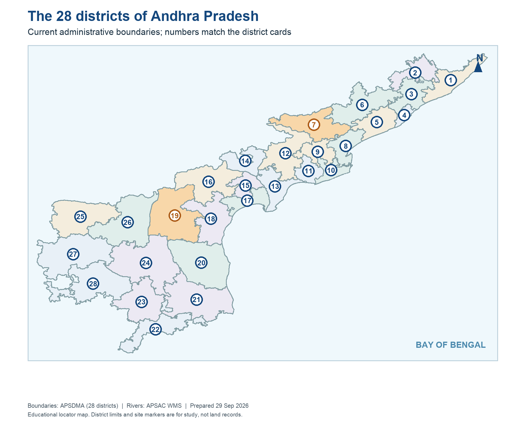
Current 28-district AP map
Numbered current districts match chapters 01-28; source APSDMA, not a legal land record.
Read this visual
All numbered current district polygons match the first 28 chapters. The layer is an educational locator; a Gazette controls legal boundaries.
Current district geometry: APSDMA. Current district names and headquarters: credited official directories and portals.