Headquarters: Tirupati. A southern district connects the Tirumala hills, inland plains and the coastal Pulicat-Sriharikota belt. Locate this district first in relation to the coast, the Godavari or Krishna corridors, the Eastern Ghats or the Rayalaseema plateau. These physical belts often reveal why a crop, port, reservoir or pilgrimage place appears in a district question. Read the number on the accompanying current-boundary map before memorising a headquarters. A town name on a pre-2022 map can remain correct geographically but lead to the wrong present-district option.
Exam anchor: Tirumala temple, Sriharikota launch centre and Pulicat lagoon are different institutional and geographic anchors. This is a place-to-theme association, not a claim that every landmark in the surrounding region belongs inside the district. Keep a separate column for a river or landscape, a site or activity, and the administrative headquarters. In a map question, begin at the state outline, narrow to the regional belt, and only then select the district polygon. The order is more dependable than recognising a familiar town name in isolation.
Boundary and date caution: Tirumala is a hill temple area; Tirupati is the district headquarters. Older Chittoor or Nellore tags may reflect pre-2022 boundaries. District-level population, area, output and mandal totals are especially sensitive to reorganisation. An exact figure should carry its reference year and boundary vintage; this book does not silently attach an old census total to a new polygon. If the stem quotes an older notification, answer for that date. If it asks for the current district, use the 2026 map and official district portal.
Worked example: Tirupati district includes the hill pilgrimage destination and a southern coastal reach. A pre-2022 Chittoor description may still be geographically true but administratively outdated. A question about the temple should not be answered by assuming all nearby southern sites share one district. Use the current map to separate Tirupati, Chittoor and Annamayya after identifying the shrine.
Active recall: Name the headquarters of Tirupati; place it on the map; give one physical-geography anchor and explain the dated boundary trap above.
Krishna and central coast
Read NTR, Krishna, Guntur, Palnadu, Bapatla, Prakasam and Markapuram on current boundaries.
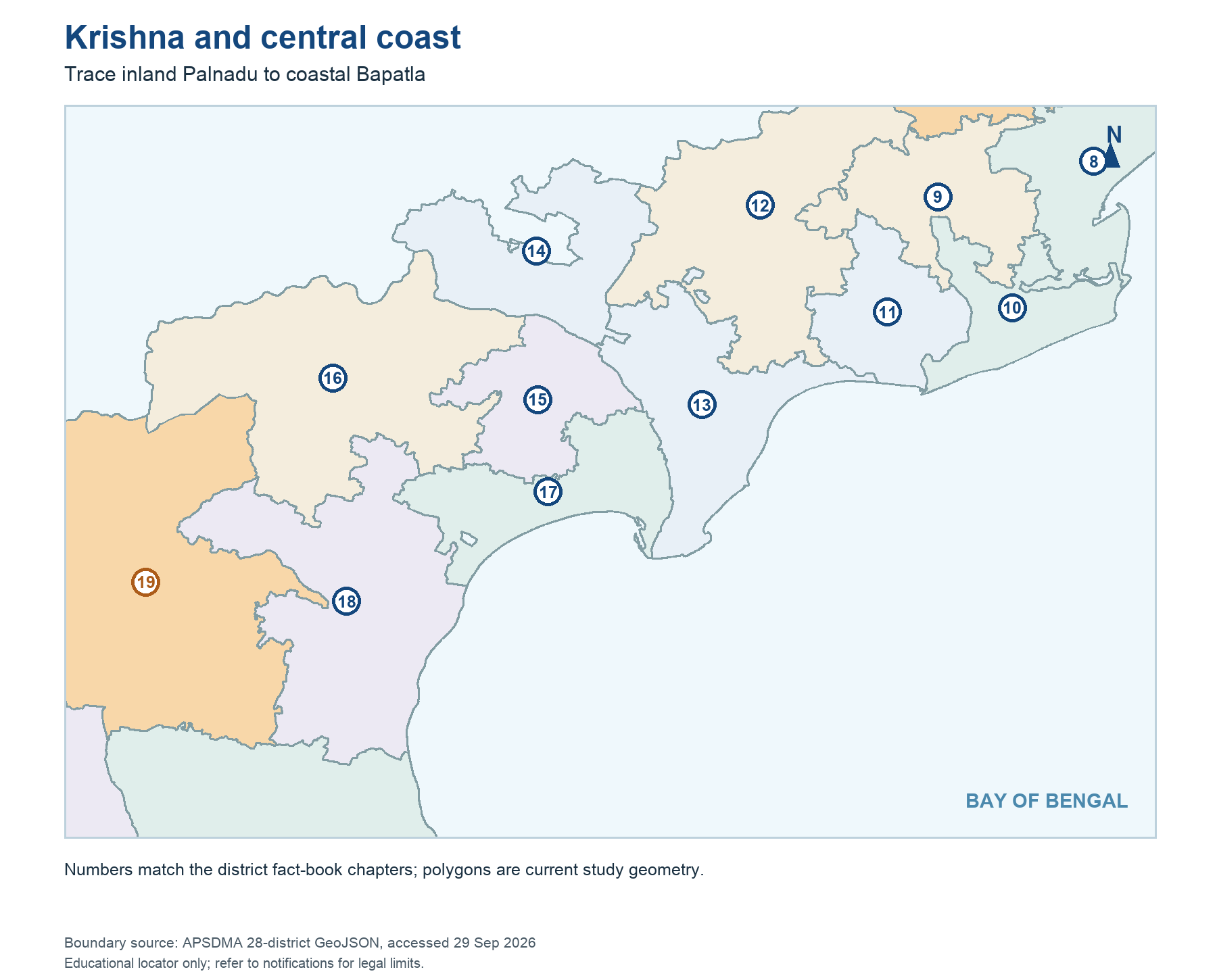
Read this visual
NTR and Krishna, Guntur and Palnadu, and Prakasam and Markapuram are distinct current units. Do not copy an older parent total onto a smaller polygon.
Current district geometry: APSDMA. Current district names and headquarters: credited official directories and portals.