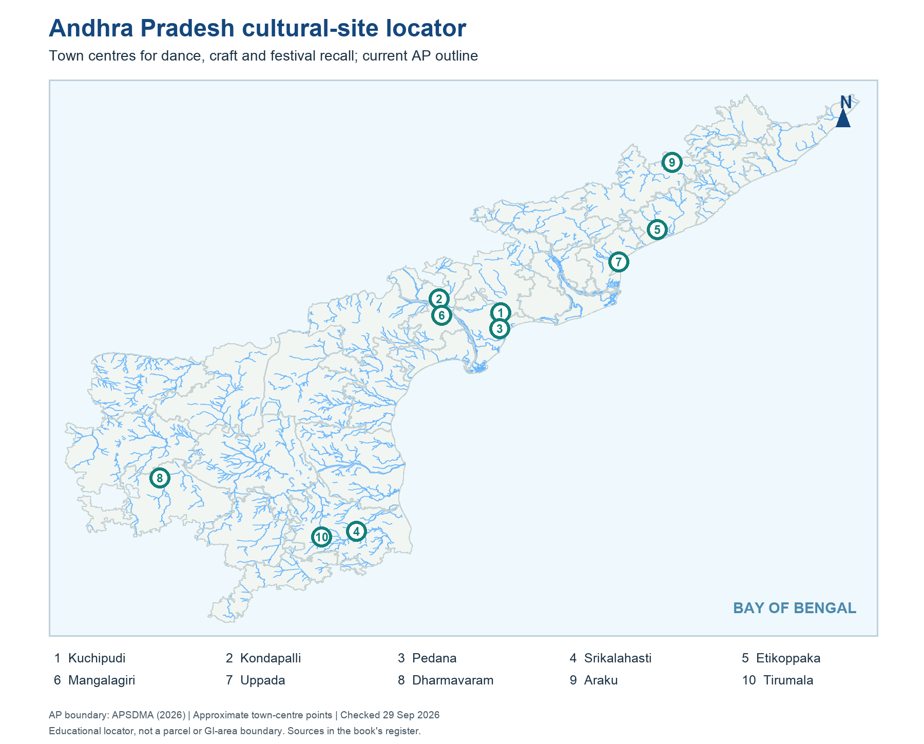
The numbered cultural-site map uses the current 28-district AP outline and approximate town-centre points. It places Kuchipudi and Pedana near the Krishna delta; Kondapalli and Mangalagiri inland around the Vijayawada-Guntur corridor; Etikoppaka and Araku toward the northeast; Uppada on the Godavari coast; Dharmavaram in Rayalaseema; and Srikalahasti and Tirumala in the southern belt. The map is a retrieval aid, not a legal boundary map or proof that only one town practices a craft.
Historical names must be translated carefully. Kondapalli is now in NTR district, but older cultural sources may still say Krishna. Etikoppaka is in present Anakapalli district. Srikalahasti and Tirumala are in the present Tirupati district context. A GI application may preserve the district name that existed when it was filed; current administrative location can differ. To answer an MCQ, look at the question's date and whether it seeks the origin centre, current district or registered geographical area.
Worked example: Cover the labels on the cultural-site map. Mark Kuchipudi village, Pedana, Kondapalli, Etikoppaka, Srikalahasti and Tirumala by broad corridor before checking the point names. A map point locates a town or craft cluster, not every practitioner or a GI production boundary. Repeat the exercise in reverse: given the craft, find its approximate region.
Active recall: Locate Kuchipudi, Kondapalli, Etikoppaka, Araku and Srikalahasti on an unlabelled AP outline. Which two are near the northern hill/coast belt?
Cultural-site locator
Approximate town centres on the current AP outline; not legal GI boundaries.
Read this visual
Approximate site points orient craft and performance towns; they are not legal GI boundaries. Match each point to a product or form before reading its current district name.
Current district geometry: APSDMA. Cultural and GI details: credited public-body and registry sources.