A statewide scheme still depends on local implementation. Andhra Pradesh's current 28-district map helps locate district administration; below it lie revenue divisions, mandals, gram panchayats and urban wards with different responsibilities. A district collector may coordinate, while a department's district officer, school, depot, hospital or municipality verifies and delivers. The name of the lowest-level office depends on the scheme. Do not assume that every grievance is decided by the collector personally.
The AP Socio Economic Survey 2024-25 still uses the older 26-district arrangement. A coverage count for a former parent district cannot simply be relabelled as a count for Polavaram or Markapuram. Statewide totals can remain meaningful while district breakdowns need recalculation. A map with current boundaries should therefore be paired with a date rule.
For recall, place Srikakulam, Visakhapatnam, the Godavari districts, Amaravati-region districts and the southern interior. Then imagine a service chain: state order to district instructions to local verification to beneficiary. Geography helps explain why travel cost and staffing can affect take-up even under identical rules.
Worked example: A state scheme reaches a district office, then a mandal or municipal service point, then a school or household. Draw the route for the scheme being studied, because not every programme uses the same offices. A new district boundary changes the administrative label but does not automatically alter a person's entitlement. The controlling order, service area and records determine the practical handoff.
Active recall: Why does a statewide benefit need local officers? Why cannot an old 26-district table be painted onto the new 28-district map without recomputation?
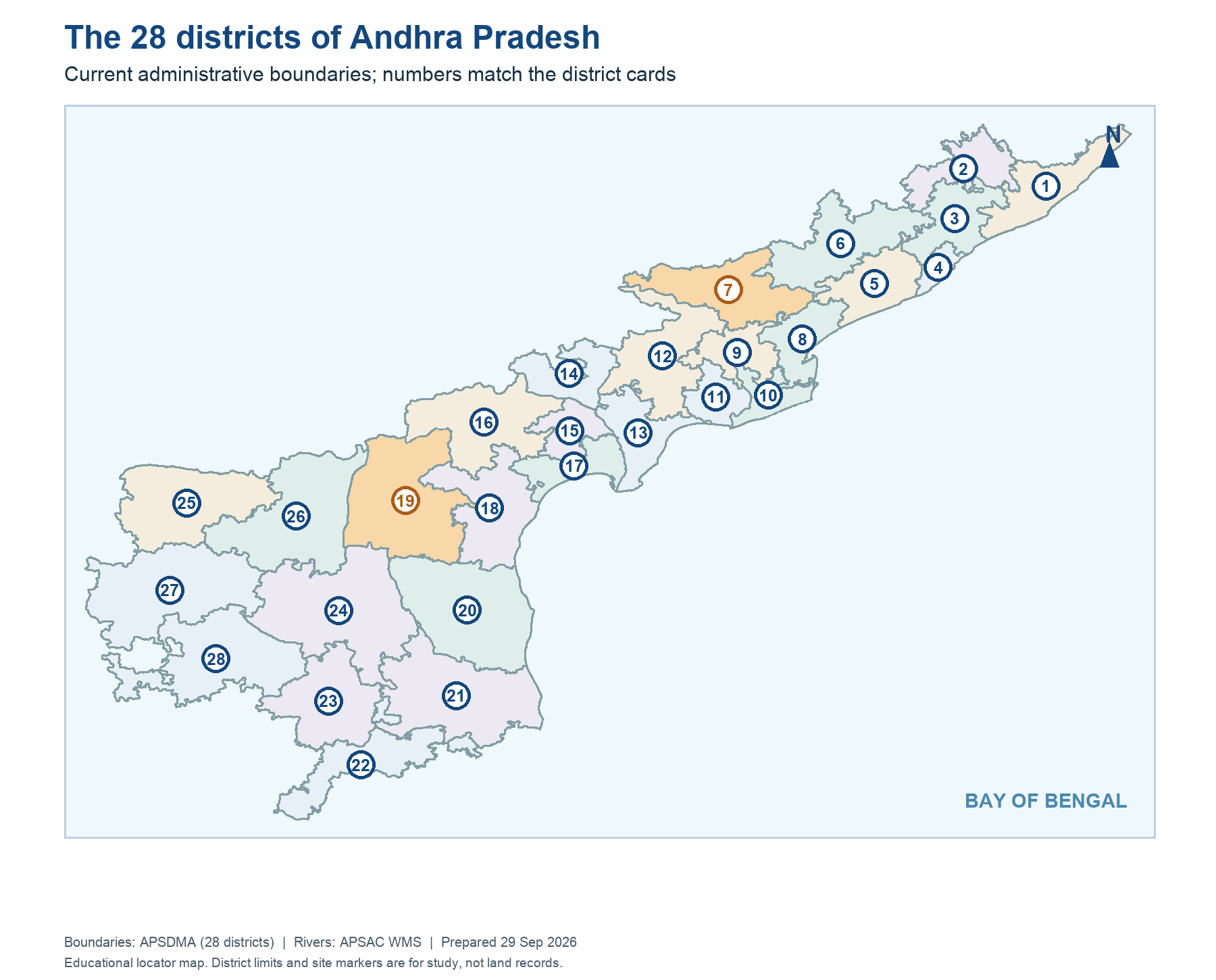
The current 28-district delivery map
The map locates administration. It does not claim measured uptake in any district.
Read this visual
The numbered polygons locate the present district administrations. Colour and number do not indicate scheme uptake. A count from an earlier district arrangement cannot be reassigned to a new polygon without the underlying locality data.
District geometry: APSDMA. Scheme details: dated government orders, departments, APSRTC and AP Finance Department.
28 district map key
01 Srikakulam | 15 Guntur |
02 Parvathipuram Manyam | 16 Palnadu |
03 Vizianagaram | 17 Bapatla |
04 Visakhapatnam | 18 Prakasam |
05 Anakapalli | 19 Markapuram |
06 Alluri Sitharama Raju | 20 Sri Potti Sriramulu Nellore |
07 Polavaram | 21 Tirupati |
08 Kakinada | 22 Chittoor |
09 East Godavari | 23 Annamayya |
10 Dr B R Ambedkar Konaseema | 24 YSR Kadapa |
11 West Godavari | 25 Kurnool |
12 Eluru | 26 Nandyal |
13 Krishna | 27 Anantapuramu |
14 NTR | 28 Sri Sathya Sai |