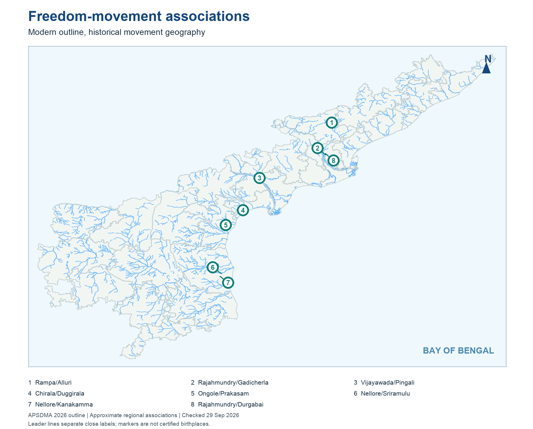
The locator map uses the current AP outline and approximate centres of documented associations. It places Alluri's forest-agency struggle in the northeast hill belt, Gurajada and Gidugu in the Vizianagaram/Srikakulam language-cultural region, Kandukuri and Durgabai in the Godavari-Rajahmundry area, Pingali and Duggirala in the Krishna/coastal central belt, Prakasam near Ongole, and Potti Sriramulu and Tikkana toward Nellore. These are study anchors rather than precise birth sites or boundaries of influence.
Historical geography changes the answer. The present Alluri district was reorganised again after 2022. Older sources can say East Godavari, Krishna or Guntur for activities in a locality whose current district has a different name. A map marker does not settle a disputed birthplace, and it cannot show where a person studied, worked and travelled throughout life. Use it to eliminate impossible regional swaps, then return to the biographical source for the exact claim.
Worked example: A current district map marks a freedom movement region. The marker shows where an event or a person's work is associated, not certified birth coordinates. Keep the historical village and 1920s district terminology in the source column; then translate to current geography if the question asks it. A person can work in several places and still have only one birthplace.
Active recall: Place the northeast Agency, Rajahmundry, Vijayawada, Ongole and Nellore on an unlabelled map. Attach one figure to each.
Freedom-movement association map
Current AP outline; approximate historical regional associations, not birthplaces.
Read this visual
The markers show broad historical associations, not certified birthplaces. Classify each point as movement region, work location or commemoration before matching a person.
Current district geometry: APSDMA. Biographical and literary claims: credited official and public-body sources.