Kolleru is a freshwater lake and wetland between the Krishna and Godavari delta regions. Pulicat is a brackish lagoon spanning AP and Tamil Nadu near the southern coast; the Tirupati district page highlights its birds and the Sriharikota connection. These are different water bodies. “Both have birds” is not enough to answer a map or ecology question. Look for fresh versus brackish water, central delta versus southern border and inland lake versus coastal lagoon.
District associations around wetlands may cross more than one current administrative boundary. Conservation areas can have their own legal boundaries, distinct from the open water extent on a tourist map. Do not use a bird photograph to prove a particular sanctuary; a flamingo may move. For exam practice, draw one small blue lake between the two river deltas and one long southern lagoon along the AP-Tamil Nadu coast. Then add Coringa's mangroves to the Godavari estuary to complete the three-way comparison.
Worked example: Kolleru and Pulicat are wetlands in different parts of AP's coastal geography. Do not merge them because both attract birds. Mark Kolleru between the Krishna and Godavari systems and Pulicat toward the southern coast. Bird sightings and access can vary by season; the map location is more stable than a one-year bird-count headline.
Active recall: Classify Kolleru, Pulicat and Coringa by water type and region. Which spans two states?
Nature-site locator
Caves, hills, wetlands and mangroves occupy different AP regions.
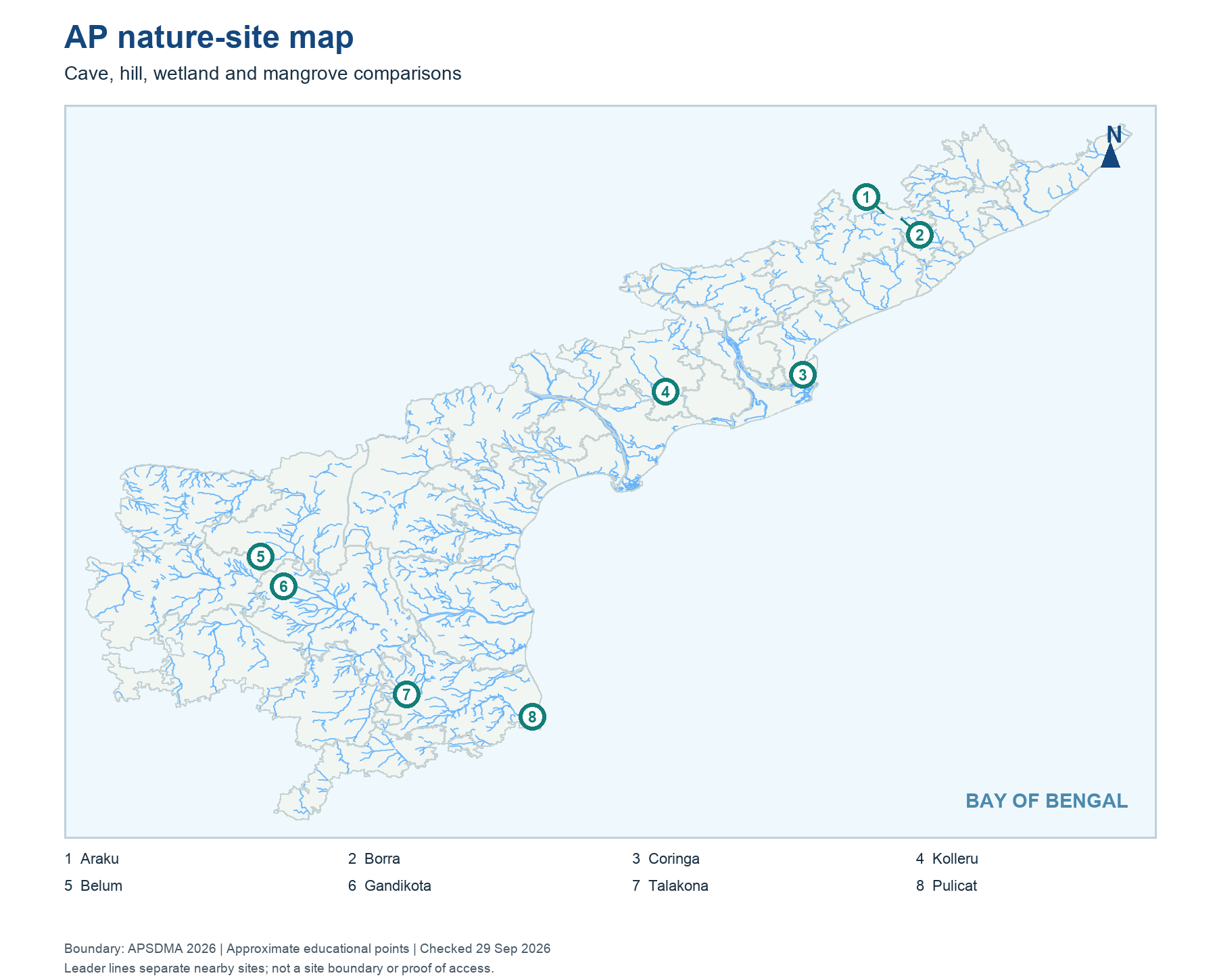
Read this visual
Map wetlands, mangroves, caves and hills by physical geography. A tourism facility or wildlife sighting is more date-sensitive than the site's broad location.
Current district geometry: APSDMA. Site status and access: credited tourism, archaeology, UNESCO and forest sources.