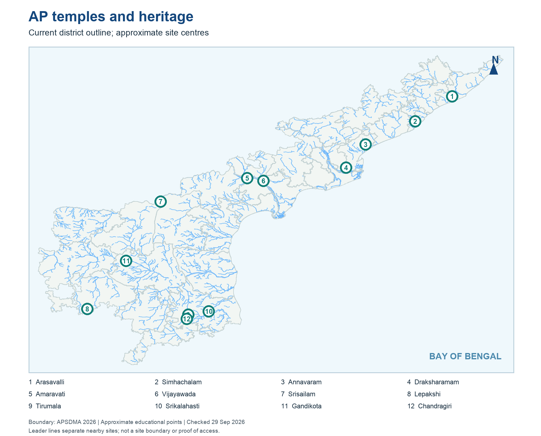
The book's locator uses the current 28-district AP outline and approximate site centres. It puts Buddhist coastal sites toward Srikakulam, Visakhapatnam and Anakapalli, the Amaravati-Nagarjunakonda group along the Krishna region, and major southern shrines around Tirupati, Nandyal and Sri Sathya Sai. The map is an exam retrieval aid, not a protected-monument boundary map. A marker represents a town or broad site location; it does not define a temple's land parcel, cave entrance or wildlife sanctuary limit.
Administrative change creates a predictable trap. Older tourism material may place Lepakshi in Anantapuramu, whereas its present district is Sri Sathya Sai. Draksharamam can appear under East Godavari in legacy pages but is now in Dr B R Ambedkar Konaseema district. Some tourism brochures predate the 2022 district creation and later boundary changes. When an MCQ uses “currently,” rely on the dated current map or official present district site; when it asks about an old historical record, preserve the label used at that time. Always locate the town before translating the district.
Worked example: A 2015 brochure places Nagarjunakonda in an old district while a 2026 map shows revised boundaries. The archaeological site has not moved. Keep the brochure's historical administrative label for its own date and use the current district map for a present-day question. Before answering, underline whether the stem asks where the monument is, which district currently administers it or what an older source called the district.
Active recall: On a blank outline, put Lepakshi, Draksharamam and Srikalahasti. Which two have particularly common older-district labels?
AP heritage locator
Current AP outline; approximate centres, not protected-site boundaries.
Read this visual
The locator is a current administrative orientation layer; each marker is an approximate site centre. It neither states protected boundaries nor reproduces old district maps.
Current district geometry: APSDMA. Site status and access: credited tourism, archaeology, UNESCO and forest sources.