Buddhist remains in present AP occur in coastal and river-connected settings. Stupas, monasteries, sculpture, inscriptions and museum collections show that the tradition was not confined to one town. The AP Tourism policy names Salihundam, Thotlakonda, Bojjannakonda, Bavikonda, Amaravati, Undavalli and Nagarjunakonda in proposed Buddhist tourism clusters. Those names are not all the same monument type: Undavalli is a rock-cut cave complex with a complex later history, while the others include stupa or monastic remains.
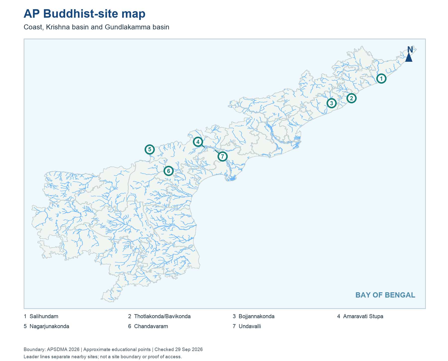
The coast and rivers helped movement of people and ideas, but an exam answer should not infer a precise trade route from an unsourced map line. Use the site type and location first. The northern cluster lies toward Srikakulam and Visakhapatnam/Anakapalli; Amaravati and Nagarjunakonda are linked with the Krishna basin, while Chandavaram lies by the Gundlakamma. Buddhist phases, patrons and art styles changed over time. A single chapter label such as “Buddhist AP” is a starting category, not a claim that every site was contemporary or identical.
Worked example: On the Buddhist-sites map, locate the Krishna valley cluster and the northern coast. Archaeological exchange followed routes broader than today's district lines. A site with a stupa near the coast and one near the Krishna can share Buddhist heritage without being the same monument. Learn the corridor first, then match individual sites and present administrative names.
Active recall: What two geographic corridors help place AP Buddhist sites? Why should Undavalli not simply be called a stupa?
Buddhist heritage locator
Coastal, Krishna and Gundlakamma clusters; nearby marks can share a regional point.
Read this visual
Trace the Krishna-valley and north-coastal Buddhist clusters. Nearby marks can represent separate monuments; read labels before merging them.
Current district geometry: APSDMA. Site status and access: credited tourism, archaeology, UNESCO and forest sources.