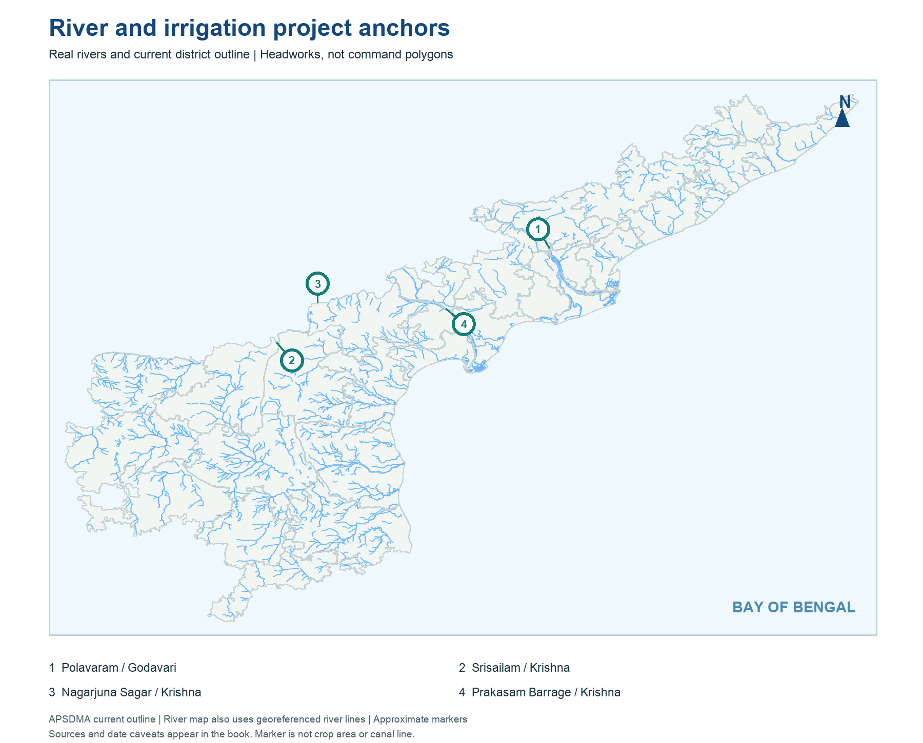
Andhra Pradesh's major irrigation geography is organised around river basins, especially Godavari, Krishna and Pennar, with other coastal rivers and local tanks also important. A basin is the land draining toward a river; a canal command is the area served by a particular irrigation work. The two need not share one boundary. The genuine locator map places selected river/project anchors on the current AP outline without pretending to draw every canal line.
Read project names with their river and purpose. Prakasam Barrage and Nagarjuna Sagar are linked with Krishna irrigation; Polavaram is on the Godavari. Handri Neeva draws from the Srisailam reservoir setting and conveys water toward southern districts, according to Kurnool's official project page. A reservoir dashboard can show changing storage, but a static study note should not repeat a daily water level. Learn the map and basic link first, then revisit project status from current official records.
Worked example: Trace the Krishna and Godavari on a map before matching projects. Both are major AP irrigation basins, but not every canal carrying water from one river lies beside the river's lower delta. Mark the main river, headworks and broad command separately. A project marker is a headworks point, not the shape of every beneficiary field.
Active recall: Match Krishna, Godavari and Srisailam-linked southern conveyance with the named works in this chapter.
River and project anchors
Real river traces and current AP outline; project markers are headworks, not command polygons.
Read this visual
River traces and headworks markers orient the basin. They do not describe every canal alignment or the actual irrigated command.
Current district geometry: APSDMA. Crop and irrigation claims: credited agriculture and water-authority sources.