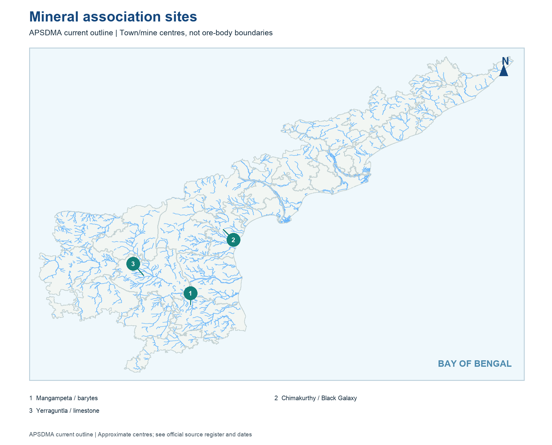
The first map uses actual APSDMA district geometry for selected mineral anchors: Mangampeta barytes, Chimakurthy granite and a limestone example from the central AP belt. The second locates documented industrial and SEZ centres including Visakhapatnam, Atchutapuram, Kakinada and Sri City. The third orders major port points along the Bay of Bengal coast. None of the markers draws a certified deposit polygon, factory plot boundary or navigational channel.
Location questions must carry current geography. Mangampeta is in current Annamayya district in its district survey, although older YSR Kadapa pages describe the mine in their former district context. Sri City's older central SEZ entries may say Chittoor; the present Satyavedu area is associated with Tirupati district. A historic document can be accurate for its own date without supplying today's administrative answer. Read the map legend before assigning the district.
Worked example: The three locator maps use approximate site centres on the current AP outline. A mineral point is not a deposit polygon; a SEZ point is not a legally notified parcel; and a port marker is not a navigational chart. Cover their labels and identify one mineral site, industry centre and port in north-to-south order, then state what each symbol cannot prove.
Active recall: Explain why a current-district map and a 2007 SEZ notification may use different district names for the same site.
Documented mineral associations
Current outline; Mangampeta, Chimakurthy and Yerraguntla are approximate centres, not deposit polygons.
Read this visual
These are approximate mineral-site centres on current districts, not deposit or lease polygons. Compare Mangampeta, Chimakurthy and Yerraguntla by resource and process.
Current district geometry: APSDMA. Mining, industry, SEZ and port claims: credited issuing bodies.