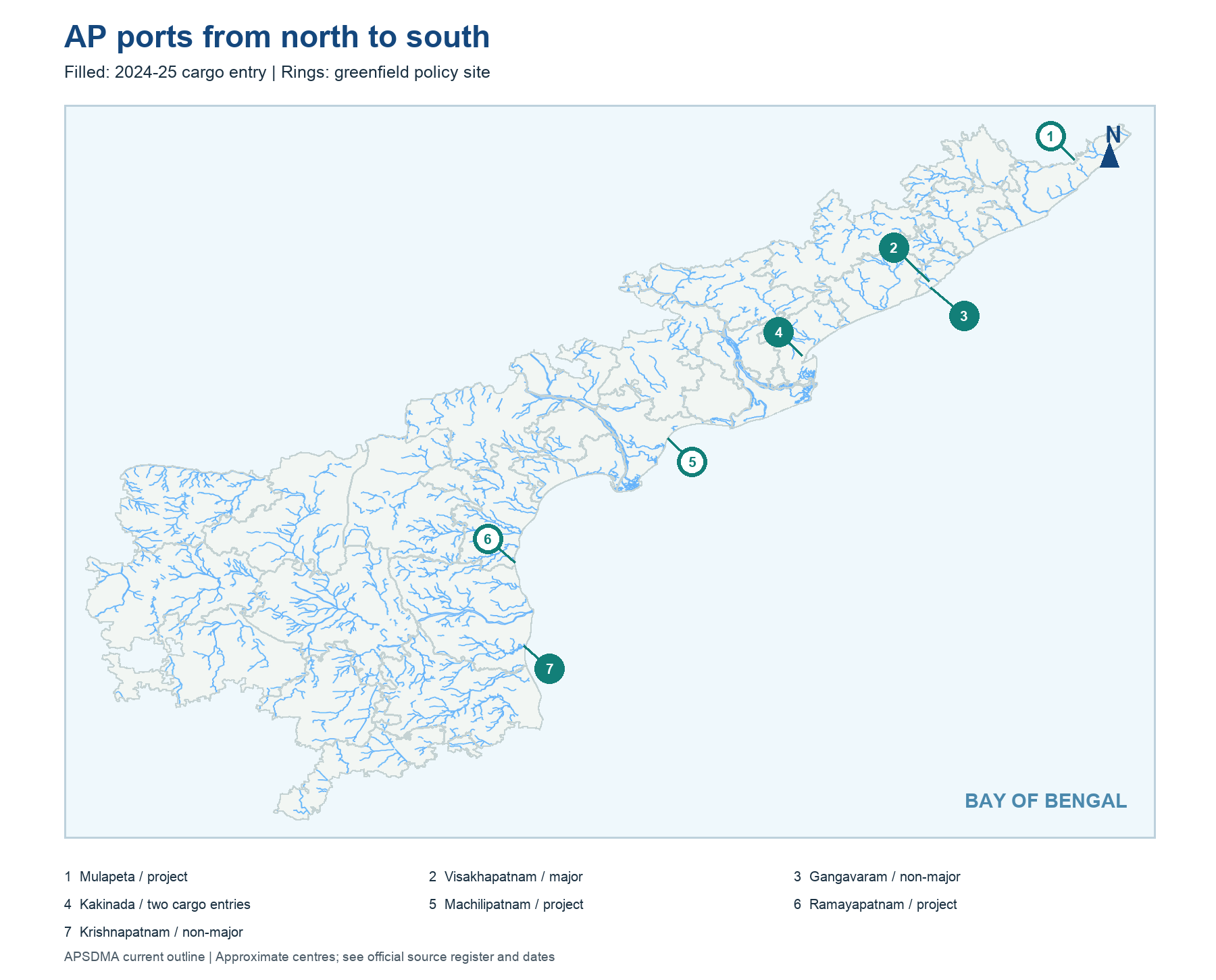
Cover the labels on the coast map. From north toward south, locate Mulapeta's project area, Visakhapatnam and nearby Gangavaram, Kakinada, Machilipatnam's project area, Ramayapatnam and Krishnapatnam. This is a geographic ordering exercise, not a statement that every named project is operating. The map uses current AP districts and points with leader lines where two ports are close.
The Bay of Bengal lies east of the coast. A western inland mineral point cannot be treated as a deep-water port merely because its product may ultimately travel to the shore. Also distinguish Kakinada Anchorage and Kakinada Deep Water in the source table even if one map point labels the city. A precise berth map would require port charts; the state locator does not show channels or terminals. Status should be read from the adjacent dated caption and source register.
Worked example: Trace the AP coast from the north around Visakhapatnam and Gangavaram through Kakinada toward Krishnapatnam. Two markers can be close without being the same port; a ring can mean planned rather than operating. Cover the legend and say which sites have dated cargo evidence. The map is for geographic recall, not harbour navigation.
Active recall: Put Gangavaram, Kakinada and Krishnapatnam in north-to-south order, then identify the major port neighbour of Gangavaram.
AP port order map
Filled symbols have 2024-25 cargo entries; rings show greenfield policy sites without claiming current operation.
Read this visual
Filled port symbols have dated cargo entries; rings show greenfield policy sites. Close coastal markers can belong to separate ports.
Current district geometry: APSDMA. Mining, industry, SEZ and port claims: credited issuing bodies.