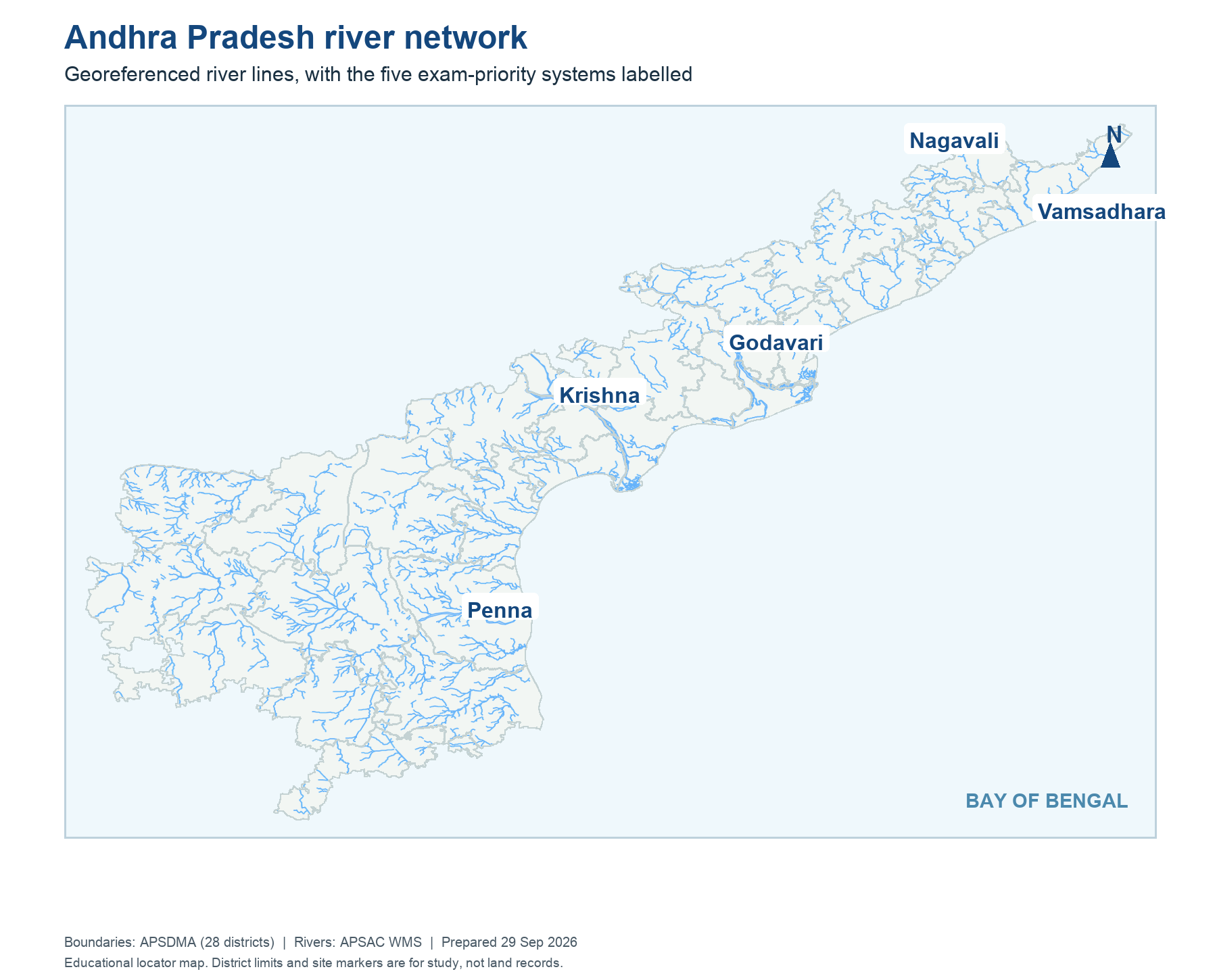
Several AP rivers descend from interior hills and plateaus toward the Bay of Bengal. The north-east has shorter systems such as Vamsadhara and Nagavali; the large Godavari and Krishna cross state boundaries before forming deltas; the Pennar drains the drier southern interior. Tributaries, distributaries and canals are different: a tributary adds natural flow; a distributary branches near a delta; a canal is engineered.
Trace the five priority systems on the real river map before memorising project names. A north-east headwork should not be placed on the Pennar, and a delta canal should not be drawn upstream of the storage project that supplies it.
Worked example: On a blank AP map, several rivers flow from inland highlands toward the Bay of Bengal. Trace the Vamsadhara and Nagavali in the north, Godavari and Krishna across the central belt, and Penna farther south. Do not draw a single straight line for a basin: tributaries and distributaries complicate the network. An eastward generalisation helps orientation, while an exact headwork answer requires the named river and mapped site.
Active recall: Locate the named river or project on the relevant map, name its function, and state which facts need a dated source.
AP river network map
District boundaries: APSDMA; river layer: APSAC WMS. Educational basin locator.
Read this visual
Read the river lines from inland to sea. The map distinguishes separate northern basins from the Godavari, Krishna and Penna corridors. District boundaries help locate points but do not define catchments.
District geometry: APSDMA. River layer: APSAC. Project and status details: credited water-resource agencies.