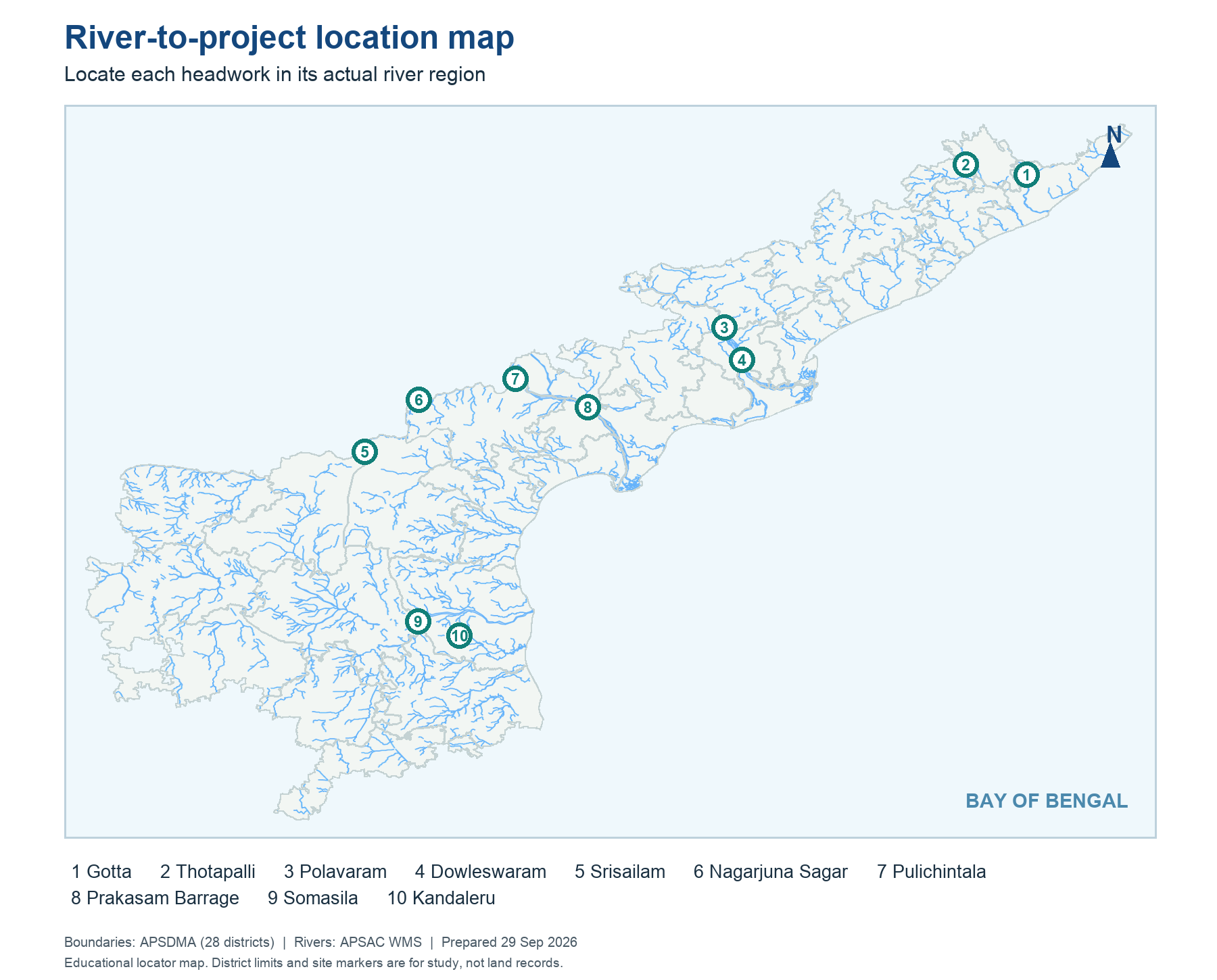
Make ten cards: Vamsadhara-Gotta; Nagavali-Thotapalli; Godavari-Polavaram; Godavari-Dowleswaram; Krishna-Srisailam; Krishna-Nagarjuna Sagar; Krishna-Pulichintala; Krishna-Prakasam Barrage; Penna-Somasila; Pennar system-Kandaleru. Reconstruct the sites on a blank map, then state whether each is a storage, diversion or transfer node.
The drill deliberately repeats river names: several projects can lie on one river, and a single scheme can move water from one river to another. The correct answer depends on the structure and location named in the stem.
Worked example: Draw ten paired labels without looking: Vamsadhara-Gotta, Nagavali-Thotapalli, Godavari-Polavaram, Godavari-Dowleswaram, Krishna-Srisailam, Krishna-Nagarjuna Sagar, Krishna-Pulichintala, Krishna-Prakasam, Penna-Somasila and the southern Kandaleru link. Then point to their relative map positions. The drill tests river identity, sequence and type. If one pair fails, trace the line physically instead of repeating the name aloud.
Active recall: Locate the named river or project on the relevant map, name its function, and state which facts need a dated source.
AP river-to-project review map
Ten marked project nodes are located on the real river and district layer.
Read this visual
Use the ten map points for two-way recall: name the river from a project and name a project from the river. Then add upstream-to-downstream order where applicable.
District geometry: APSDMA. River layer: APSAC. Project and status details: credited water-resource agencies.