Thotapalli barrage or regulator is an AP north-eastern irrigation anchor across the Nagavali. Official material links its scheme with the Nagavali and district portals may retain older Vizianagaram wording. The geographic point remains fixed while the district label can change after the creation of Parvathipuram Manyam. The water-resource record, not a tourism page, is needed for exact capacity or present operational figures.
A regulator or barrage is a headwork for diversion and level control, not necessarily a large seasonal reservoir. Place Thotapalli on the Nagavali map and explain the difference from Gotta on Vamsadhara.
Worked example: Thotapalli may be confused with Gotta because both sit in the north-eastern AP revision cluster. The simplest check is river first: Thotapalli belongs to Nagavali; Gotta to Vamsadhara. On the map, point to both separately. A question about canal benefits needs a dated command or delivery record; a question about the barrage's river can be answered from project identity without a live water bulletin.
Active recall: Locate the named river or project on the relevant map, name its function, and state which facts need a dated source.
North-eastern river map
Vamsadhara-Gotta and Nagavali-Thotapalli are separate river-headwork pairs.
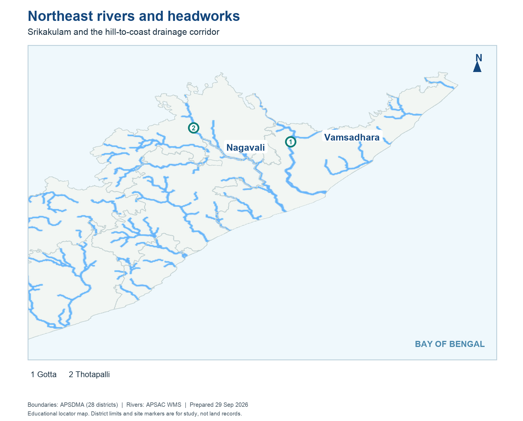
Read this visual
Trace Vamsadhara to Gotta and Nagavali to Thotapalli as two distinct pairs. The nearby north-eastern locations make this a common elimination question.
District geometry: APSDMA. River layer: APSAC. Project and status details: credited water-resource agencies.